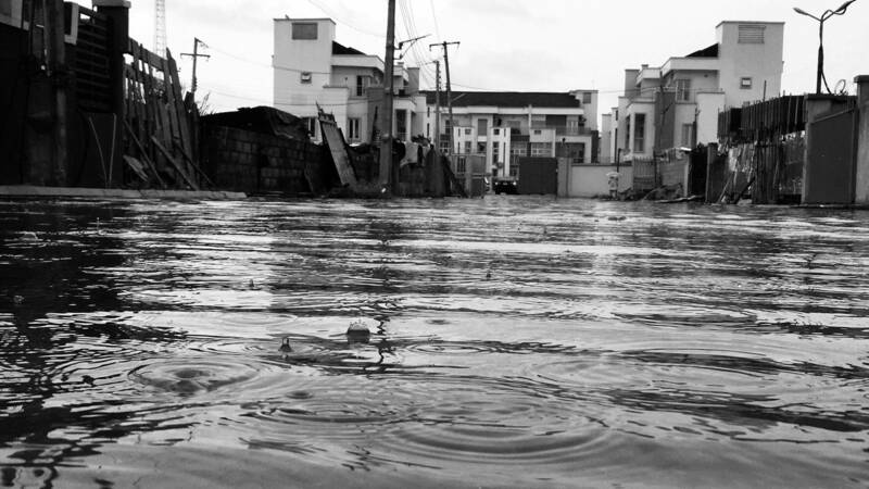
Before hurricane Harvey struck, I remember getting out of school and driving home in some light rain. At that time, only the remote edge of the hurricane had entered over Houston, and the city waited as the hurricane, only a few days away, inched closer. When I got home, my family and I began to prepare. We went through our usual hurricane preparations, but there was one added step due to the magnitude of Harvey, which was moving all of our furniture upstairs in case our house flooded. We waited around the TV for as long as we could, until inevitably the power went out, in order to get a glimpse of what the next few days would look like. After the hurricane had passed, my house did not flood, but this outcome was not the same for both my close friends and many Houstonians. I watched on the news as first responders rescued people from the roofs of their homes in flooded areas, and families were taken to highway overpasses to wait to be evacuated. During the aftermath of the hurricane, the community banded together and there were numerous organizations that arranged for people to go in and gut homes that had been flooded. The first home I went into was surreal. I realized how close I had been to having the normalcy of my life completely washed away, and this had been the reality of many people I know. Even when school resumed and normalcy started to come back, there were still piles of broken furniture and trash on the sides of the roads from the areas that had been the most impacted.
While there has been a large amount of rebuilding, the aftermath and fear of being displaced is still felt by many residents in Houston. These residents are still at risk because “Almost 13 percent of people live in a 100-year flood zone in Houston and Harris County. [...] Another half-million residents live in moderate risk areas, the 500-year flood zone” (Shapiro). The threat of hurricane-induced flooding has started to overtake the current statistical chance, based on flood maps. This means that the current maps are most likely outdated due to environmental changes and urbanization in the past years. Modeling has shown “on average, urbanization has increased the probability of an event like the flooding associated with hurricane Harvey by about 21 times. [...] Therefore, urbanization strongly exacerbated the impact that this storm has had in terms of both precipitation and flood response” (Zhang). This means that the current flood maps, which dictate who is required to have flood insurance and where government subsidized land can be, are outdated. In order to alleviate this fear, these flood maps need to be both updated and accommodate the urban changes happening in Houston.
A majority of the burden from these flooding events is felt by low-income Houstonians. These residents are living in government-subsidized housing, and they cannot move away from flood-prone areas due to lack of equity. Also, the rental prices increased after Harvey due to available properties becoming scarce after flooding, which “resulted in a rise in the homeless population in Houston, but [which] will also likely slow repatriation of the city because there are fewer safe and cheap locations available” (Ratnapradipa). Government aid has also been focused on homeowners rather than renters. Most of the renters are “Texans who […] lacked renter’s insurance […] and federal officials cut them out of $5 billion in aid and focused instead on homeowners” (Fernandez). The lack of relief and resources given to low-income residents has contributed to preventing them from moving to safer areas and rebuilding their lives in the aftermath of these natural disasters.
Another issue that has come up is the lack of flood insurance in Houston. Studies have shown that “there are only 245,249 flood insurance policies in force in Harris County through the National Flood Insurance Program, meaning that only 15.3% of housing units in Harris County have flood insurance” (Ratnapradipa). Flooding insurance is mandatory by FEMA to people who live in or on one-hundred-year flood zones if they have a mortgage or loan from a federally backed or regulated trader. The problem again lies in the fact that these maps are largely outdated and some people are not adequately warned about the danger of where they are located.
Although the state government did have a large response to the flooding and damages caused by Harvey, there is still the continued risk of flooding that has not been fully addressed. Harvey was not an isolated incident, so state officials should be looking for ways to be proactive in mitigating the next Harvey’s effects, as well as helping the low-income community that was heavily affected. In order to help mitigate the impact of hurricane-induced flooding on low-income citizens, the state officials should increase the amount of flood-insurance coverage through revised flood maps and mandatory flood insurance in high-risk areas.
My proposal to increase flood insurance coverage is primarily by re-analyzing old flood maps. This would not only help low-income families, but also many Houstonians. Research has been done about locations of flood damage, and “researchers noted that the vast majority of flood damage occurred outside the FEMA-designated 100-year flood plain (Blessing, Sebastian, and Brody). One of the reasons for “this gap might be due in part to the fact that several years passed in between FEMA’s map updates” (Ratnapradipa). Although the process of developing a flood map takes around three to five years, overall, the development of a new flood map based on recent data could help residents better understand what risk they currently face. The revised flood maps would lead to more mandatory flood insurance in risk-prone areas and a better knowledge of whether it should be purchased, which will help low-income families recover faster from flooding events. To increase the accuracy of these flood maps, urbanization should also be taken into consideration with flood risk. These updated maps should include models that account for urban flooding, “a hazard that is currently not considered in FEMA’s flood maps” (Kunreuther). The issue of urban flooding is not insignificant in Houston, so there should be a greater emphasis on urban sprawl’s effect in the updated FEMA flood maps. Accommodating for this risk is feasible, and there is technology in place in order to properly accommodate urbanization on rainfall. The research conducted by Wei Zhang, Gabriele Villarini, Gabriel A. Vecchi and James A. Smith uses the WRF model in order to accommodate increased runoff from urban development. This will then be used in conjunction with FEMA’s current floodplain analysis methods in order to make a more accurate flood map that accommodates for urban flooding. Although the process would take time to fully complete, the result would mean that the government would need to take this new data into consideration when deciding which areas to subsidize, allowing for these families to be placed in safer areas or in more flood-resistant buildings.
Another application of these revised flood maps is a state-required flood insurance. This is something that the Texas government could implement accurately with the help of the new maps, and it would help alleviate the financial burden of flooding on both low-income residents and those in flood prone areas. A report on Harvey indicated that of the 204,000 homes damaged “Three-fourths were outside of the 100-year floodplain. Those homeowners did not have flood insurance” (Amadeo). Many Houstonians do not have flood insurance when they are actually at risk, and this lack of insurance can make it extremely difficult or almost impossible to rebuild, which is evident by the increased rate of homelessness after Harvey. Along with this, many low-income residents do not know the risk they are in and may not be told to buy flood insurance when it is needed. The flood insurance would be mandated for people in both 100- and 500-year flood plains in order to increase the amount of people covered for the next major flood event. This will help alleviate the harm to low-income residents by providing financial support through insurance agencies because government aid has been limited in past flood events. This proposal is modelled after the Flood Protection Act of 1973 that congress passed, “which created a mandate for vulnerable property owners to purchase flood insurance” (Kunreuther). This can then be extended to low-income residents through a program similar to the Flood Insurance Affordability Act. The flood protection act was contended due to varying rates based on individual risk, so congress passed this act in order to halt or slow rate increases to make it more equitable. This same principle of halting or slowing down rates to make it more affordable to low-income households can be used to make the Texas government’s act more affordable. The dissent from the congressional act came from insurance rates based on outdated FEMA maps. The insurance premium charged to those at risk would be more accurately based on the flood maps. The new flood maps would allow for the application of mandatory flood insurance coverage, while implementing policies to keep it affordable for low-income residents. This overall will be used to increase flood protection and allow for families and people to more easily recover from increasingly severe flood events.
Taxpayers will point out that this program would increase the amount they will have to pay in order to offset the cost of subsidizing insurance for low-income households. This will inevitably be the case, but all programs that are currently being developed in order to mitigate the effects of flooding in Houston will cost the taxpayers money. I am instead arguing that the overall good that this will do outweighs the cost in taxes. Harvey required Greg Abbott to need “more than $125 billion in federal relief” (Amadeo), which makes it the second most costly natural disaster in U.S. history. The economic impact of these natural disasters is already a very large amount. The state government is overwhelmed by these natural disasters, and the federal aid does not go to all of the residents in Houston. Low-income families that are renting have been left out of aid packages, so this insurance plan would be a form of aid that has been due to these fellow Texans. It would also help shift the already large burden from the state government in these situations by providing alternative ways for people to recover. While I do not know the actual figures that the insurance coverage would cost, it would allow families to recover faster and potentially require government aid for a shorter period of time, which would also offset some of the cost of the program.
The issues faced by low-income residents in Houston are felt all over the country in coastal cities. The rate of development along the coast has increased and this trend “towards urbanization provides additional pressures on the environment and increases vulnerability to natural hazards, particularly among the poor. The urban poor tend to live in informal settlements, and their housing is often inadequately constructed” (De Souza). The urban poor are both pushed into higher hazard areas because of the lower cost, and their housing usually is not elevated or otherwise made flood resistant. My proposal towards the state government to update the outdated FEMA flood maps will help people recognize the dangers of where they live and help extend insurance coverage. The state government can make this affordable to low-income families, and it will help these people recover easier from flooding. This proposal will help ease the minds of families and people who fear for their way of life every time there is a chance of heavy rain.
Works Cited
Amadeo, Kimberly. “Hurricane Harvey Shows How Climate Change Can Impact the Economy.” The Balance, 25 June 2019, www.thebalance.com/hurricane-harvey-facts-damage-costs-4150087.
Blessing, Russell, Antonia Sebastian, and Samuel D. Brody. “Flood Risk Delineation in the United States: How Much Loss Are We Capturing?” Natural Hazards Review, vol. 18, no. 3, 2017.
De Souza, Roger-Mark. “In Harm’s Way: Hurricanes, Population Trends and Environmental Change.” Environmental Issues: Essential Primary Sources, edited by Brenda Wilmoth Lerner and K. Lee Lerner, Gale, 2006, pp. 415-418, https://link.gale.com/apps/doc/CX3456400154/GIC?u=nd_ref&sid=bookmark-GIC&xid=a1e8aed0.
Fernandez, Manny. “Renters Cite Bias in Aid In Harvey Recovery Effort.” New York Times, 12 Oct. 2019, p. A12(L).
Kunreuther, Howard. “Reauthorizing the National Flood Insurance Program.” Issues in Science and Technology, vol. 34, no. 3, Spring 2018, https://issues.org/reauthorizing-the-national-flood-insurance-program/.
Ratnapradipa, Dhitinut, et al. “Implications of Hurricane Harvey on Environmental Public Health in Harris County, Texas.” Journal of Environmental Health, vol. 81, no. 2, 2018, p. 24-32.
Shapiro, Leslie, et al. “What 500-Year Flooding Could Look Like in Five Cities.” Denver Post, 32 Aug. 2017, https://www.denverpost.com/2017/08/31/hurricane-harvey-500-year-flood-comparison/.
Zhang, Wei, et al. “Urbanization Exacerbated the Rainfall and Flooding Caused by Hurricane Harvey in Houston." Nature, vol. 563, , 2018, p. 384-388, https://www.nature.com/articles/s41586-018-0676-z.
Discussion Questions
Complete a reverse-outline of this essay and analyze the essay’s structure. What is the purpose and function of each paragraph? How are the ideas sequenced? Which ideas get the most space in the essay, and why?
How does this student writer develop their ethos? Point to specific sentences that demonstrate the writer’s trustworthiness, character, and investment in the topic. Then, compare these moves to another research paper published in this edition of Fresh Writing; how are the approaches to cultivating ethos similar? How are they different?
Author